Weekend Storms Cause One Fatality

Twenty seven year-old Ryan Hiller was killed Saturday by a branch from a nearby tree that fell on his tent cabin. Hiller worked as a park ranger during busy periods, but had been working as a park concessioner and staying in the Yosemite Valley stables area while waiting for the winter ski season to start.

Our hearts and sympathies go out to Ryan’s family.

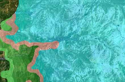
Snow and Rain Headed to Yosemite and Higher Elevations Prompts Winter Storm Warning

.A STRONG STORM DROPPING OUT OF THE GULF OF ALASKA WILL BRING UNSEASONABLY COLD WEATHER TO THE CENTRAL CALIFORNIA INTERIOR WEDNESDAY AND THURSDAY. SNOW ACCUMULATIONS COULD BE AS HIGH AS 20 INCHES OVER THE HIGH COUNTRY…WITH 6 TO 12 INCHES DOWN TO THE 7000 FOOT LEVEL. THE STORM IS FORECAST TO MOVE EAST OF THE REGION LATE WEDNESDAY NIGHT…HOWEVER SNOW SHOWERS COULD LINGER INTO THURSDAY.

SIERRA NEVADA FROM YOSEMITE TO KINGS CANYON-
TULARE COUNTY MOUNTAINS-
305 AM PDT TUE OCT 4 2011

…WINTER STORM WARNING REMAINS IN EFFECT FROM 3 AM WEDNESDAY TO 5 AM PDT THURSDAY ABOVE 7000 FEET…

A WINTER STORM WARNING ABOVE 7000 FEET REMAINS IN EFFECT FROM
3 AM WEDNESDAY TO 5 AM PDT THURSDAY FOR THE HIGHER ELEVATIONS OF THE SOUTHERN SIERRA NEVADA.

* SNOW ACCUMULATIONS: 6 TO 12 INCHES ABOVE 7000 FEET…AND 12 TO 20 INCHES IN THE HIGH COUNTRY.

* SNOW LEVEL: ABOVE 8000 FEET EARLY WEDNESDAY MORNING LOWERING TO 6000 FEET DURING THE DAY WEDNESDAY.

* TIMING: SNOW WILL BEGIN FALLING EARLY WEDNESDAY MORNING AND CONTINUE THROUGH WEDNESDAY NIGHT. THE HEAVIEST SNOW WILL FALL DURING THE DAY WEDNESDAY.

* LOCATIONS INCLUDE: SEQUOIA NATIONAL FOREST INCLUDING BIG MEADOWS AND BUCK ROCK AREAS. SEQUOIA NATIONAL PARK…QUAKING ASPEN…PONDEROSA AND SHERMAN PASS.

* WINDS: WEST WINDS OVER THE HIGH COUNTRY WILL GUST TO 70 MPH CAUSING CONSIDERABLE BLOWING AND DRIFTING SNOW.

* IMPACTS: THIS IS A DANGEROUS EARLY SEASON STORM. HEAVY SNOW ACCUMULATIONS MAY CAUSE MOUNTAIN ROADS TO BECOME BLOCKED. (Weather.gov)

Motorists should also use caution entering the park as this is the first rainstorm of the season for much of California causing roads to be slick with oil and debris washing off the road surface.

Just A Little More Rain

If you’re headed up to Yosemite today you can expect rain this morning with a slight risk of a thunderstorms for the afternoon. It’s cold with a high of only around 47F and winds NW at 15 to 25 mph. The storms will break up this evening leaving unstable air and a chance for isolated thunderstorms early, then partly cloudy after midnight. Lows tonight are expected to be around 35F with winds from the West between 10 and 20 mph.

After that it’s expected to be mostly sunny Thursday and Friday with the chance of scattered showers on Saturday and Sunday and then lots of sunshine into Memorial Day weekend.

If you’re headed up Memorial Day weekend remember to bring warm clothes because with the unseasonable weather we’ve been having it’s been getting pretty cold at night and there’s always a chance for a spring snow/hail storm in the Sierra.

Late Spring Storm Bringing Scattered Rain and Snow Along the Sierra Crest

Lateseasonstorm april182011

A late season storm passing over California is bringing with it scattered showers from the coast to the Sierra and snow along the Sierra Crest. The storm, which is expected to pass through today and into this evening, isn’t expected to bring a significant amount of snow to the already blanketed Sierra but will just add a bit of icing to the top. Showers and light rain are possible for the foothills and Yosemite Valley.

Rain/Snow Expected in Yosemite Tonight

Yosemite Association Webcam Shows a Dreary Half Dome Oct 4 2010
The Yosemite Conservancy webcam shows a dreary view of Half Dome as unseasonable cold air mass makes it’s way across California.

The cold front is expected to make it’s way into California tonight and linger tomorrow bringing with it rain for much of the Sierra and the possibility of snow up to 4″ along the Tioga Road and Tioga Pass.

Visitors to high country and Tioga Pass area are being asked to use caution and be prepared for winter-like weather. Road closures are possible.

The cold front was preceded by a mass of unstable air which generated thunderstorms up and down the Sierra for several days.

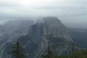
The Benefits of Rain – Yosemite Falls Flowing Again

Ominous looking thunderstorm over North and Half Dome. Photo by Jill.

One good thing about the rain is it makes all the waterfalls flow again. Edie (@ambitious_wench) is reporting Yosemite Falls, Sentinel, Horsetail, Arches and a ton of other waterfalls are flowing again. I can already think of a few locations that’ll be nice to shoot fall color with Yosemite Fall in the frame if there’s any leaves that haven’t been beat off the trees with this rain.

Warm Rains Pushing Merced to Brink

Warm rains caused increased snowmelt this weekend pushing the Merced River in Yosemite Valley almost to flood stage.

Merced Sun Star: The whirling water forced the evacuation of 71 campsites near the river, according to the National Park Service.
There were no injuries reported from the high water or the evacuation.

The surging river also increased the level of Lake McClure by more than 23,000-acre-feet in three days, which may lessen the drought’s impact on local farmers, according to the Merced Irrigation District.
An acre-foot is about 326,000 gallons, roughly the volume a Valley family would use in a year.

Yosemite Valley received 1.47 inches of rain Friday and an additional 1.11 Saturday, said Yosemite National Park spokeswoman Kari Cobb.

The combination of more than two inches of rain and a heavy snowmelt swelled the Merced River to near its flood level of 10 feet.

The river rose to nine feet Friday night and Saturday morning, said Cobb.
The National Weather Service issued a flood warning for the Yosemite Valley on Friday and Saturday. The agency predicted the river would rise to 12 feet.

Rains are expected to continue today and then break up into scattered showers on Wednesday leading into a warm and sunny weekend.