Category: Maps
-
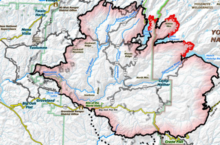
How The Rim Fire was Conquered
Check out this interesting map of the Rim Fire. It has all the firelines marked on it which makes it REALLY interesting. You can see the things the fire crews focused on, you can see lines that were cut and overrun by the fire and you can see where the fire is still burning.
-
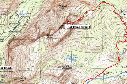
How to Read a Topographic Map
Learning how to read a topographic map is not only useful and could save your life, but it’s something fun you can do with your kids on your next trip to Yosemite.
-
Campground Highlight: North Pines
North Pines Open: April through September Reservations: Required Cost: $20/night for each campsite (maximum 6 people per site) Number of sites: 81 RV length: up to 40 ft Trailer length: up to 35 ft Pets: Yes Description: Located Yosemite Valley at 4000ft (1200m), North Pines is set in pine woodlands along the Merced River near…
-
Take the Bus
-
A Better Map For A Better Vacation
Now that fair weather is here and the the snow is beginning to melt at higher elevations, it’s time to start planning your summer vacation. One of the best things I’ve found to help me plan my trips to Yosemite is the Trails Illustrated Yosemite Topographic Map. Sure, the map you’re given at the gate…